3 things to know about the deadly Myanmar earthquake
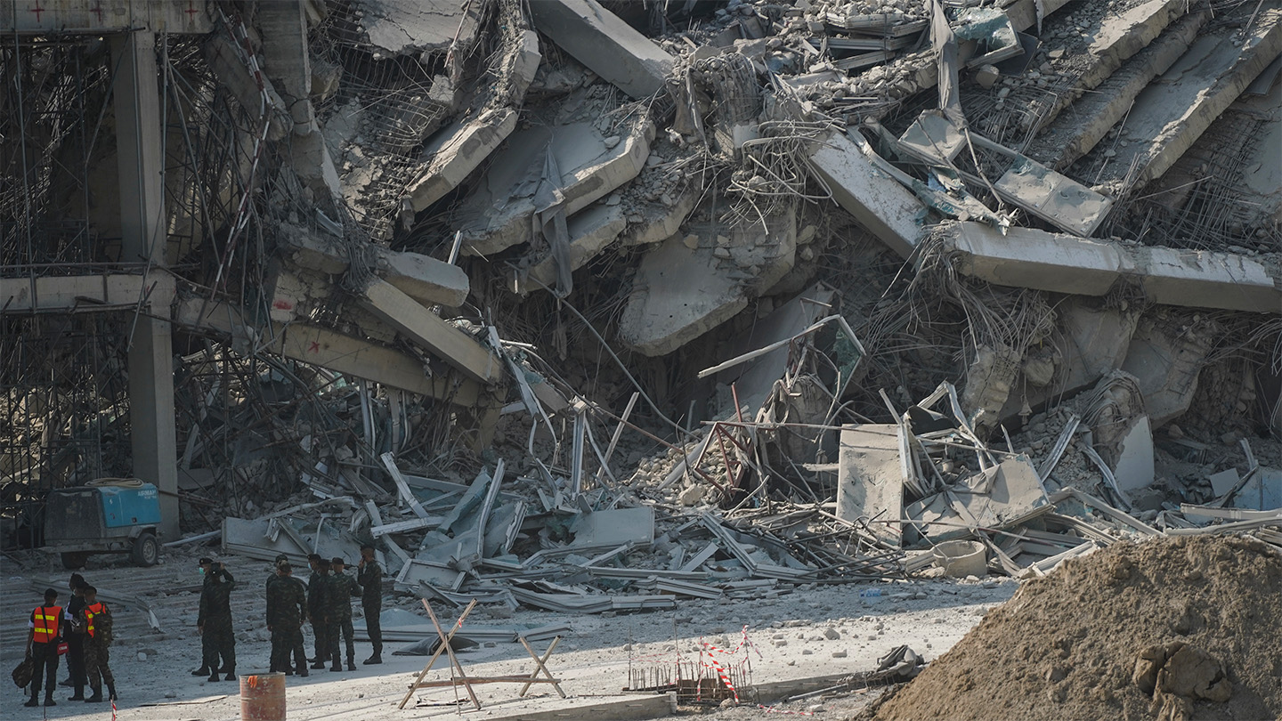
A powerful magnitude 7.7 earthquake rocked central Myanmar on March 28 at about 12:50 p.m. local time, leaving at least 144 people confirmed dead so far and triggering widespread damage across both Myanmar and Thailand. Buildings collapsed, roads broke and at least one dam and a bridge crumbled. A magnitude 6.4 aftershock followed just 10 minutes later.
With both countries declared disaster areas, international aid workers are scrambling to prepare supplies and assess the death toll and damages. Marie Manrique, Myanmar program coordinator for the International Federation of Red Cross and Red Crescent Societies, told reporters March 28 that the organization is particularly concerned about damages to public infrastructure, including large-scale dams.

An earthquake’s devastation is the result not only of its magnitude, but also its location and depth: Shallow quakes, even if they’re less powerful, can cause intense shaking at the ground surface, posing threats to infrastructure in populated areas. This quake had a trifecta of dangers: It was powerful; shallow, with the epicenter at just 10 kilometers depth; and in a heavily populated region with vulnerable buildings and other structures.
Here are three things to know about how and why this earthquake occurred.
It was a strike-slip earthquake.
This earthquake was probably the result of sideways, or strike-slip, movement along the Sagaing Fault, a large fault that runs north to south through central Myanmar, according to the U.S. Geological Survey’s Earthquake Hazards Program.
Strike-slip earthquakes occur when two blocks of tectonic crust are trying to slide sideways past each other; the blocks of crust may briefly lock due to the friction, then wrench free, releasing a burst of seismic energy through the ground.
The Sagaing Fault is part of a complex and hazardous plate boundary.
The fault marks the collision between the India tectonic plate, which includes the Indian subcontinent and part of the Indian Ocean, and the Sunda Plate, a smaller bit of crust that includes parts of Southeast Asia, including the Malaysia Peninsula.
As the India Plate slides northward, it grinds sideways against the Sunda plate to the east, occasionally generating powerful quakes. The Sagaing Fault region itself is rife with seismic hazards, and many large strike-slip quakes have occurred in the area over the last century, including a magnitude 7.0 in 1990 and a magnitude 7.9 in 1912, according to the USGS. From 1930 to 1956, there were six quakes greater than magnitude 7 on the Sagaing Fault itself that killed hundreds.
The India Plate’s northward drive has also put it on a collision course with the Eurasian Plate. That ongoing clash continues to push up the Himalaya mountain range and the Tibetan Plateau. It has also caused some of the deadliest quakes in the Himalaya region, including the 2005 Kashmir quake that killed tens of thousands of people.
Danger zone
The March 28 earthquake’s epicenter (black star) was 10 kilometers belowground, nearest the city of Mandalay, Myanmar. Red zones show regions of greatest shaking intensity.

Liquefaction is a known hazard in the region.
Regions with thick layers of loose soil can be prone to liquefaction during quakes. That process is a deadly interaction between seismic waves and the sediment that temporarily causes the soil to behave like quicksand.
Earlier quakes in this region have triggered landslides and liquefaction that greatly added to the death toll of those past events — and may have contributed to this quake’s devastation, although it’s too soon to know the extent of the damages.
Source link